Idea for March 2026: the AuthaGraph
My idea of the month is the AuthaGraph.
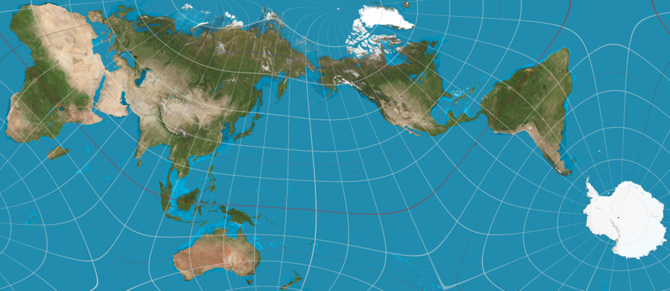
This is a map of the world that shows much more accurately the size and shape of the continents and oceans. And it makes you feel differently about our planet. In particular, it shows that the countries of the north aren’t nearly as big as we think.
It was invented back in 1999 by a Japanese architect, Hajime Narukawa.
The trick is to divide the earth’s sphere into 96 triangles, which can then be laid out flat as a map.
The word comes from ‘authalic’, meaning same-area (Greek autos ‘same’ plus ailos, ‘area’).
(Image: Felagoth, CC BY-SA 4.0 <https://creativecommons.org/licenses/by-sa/4.0>, via Wikimedia Commons)